
Harness the power of laser scanning by Shillong Design for precise 3D spatial data capture of site environments. Explore its applications and benefits.
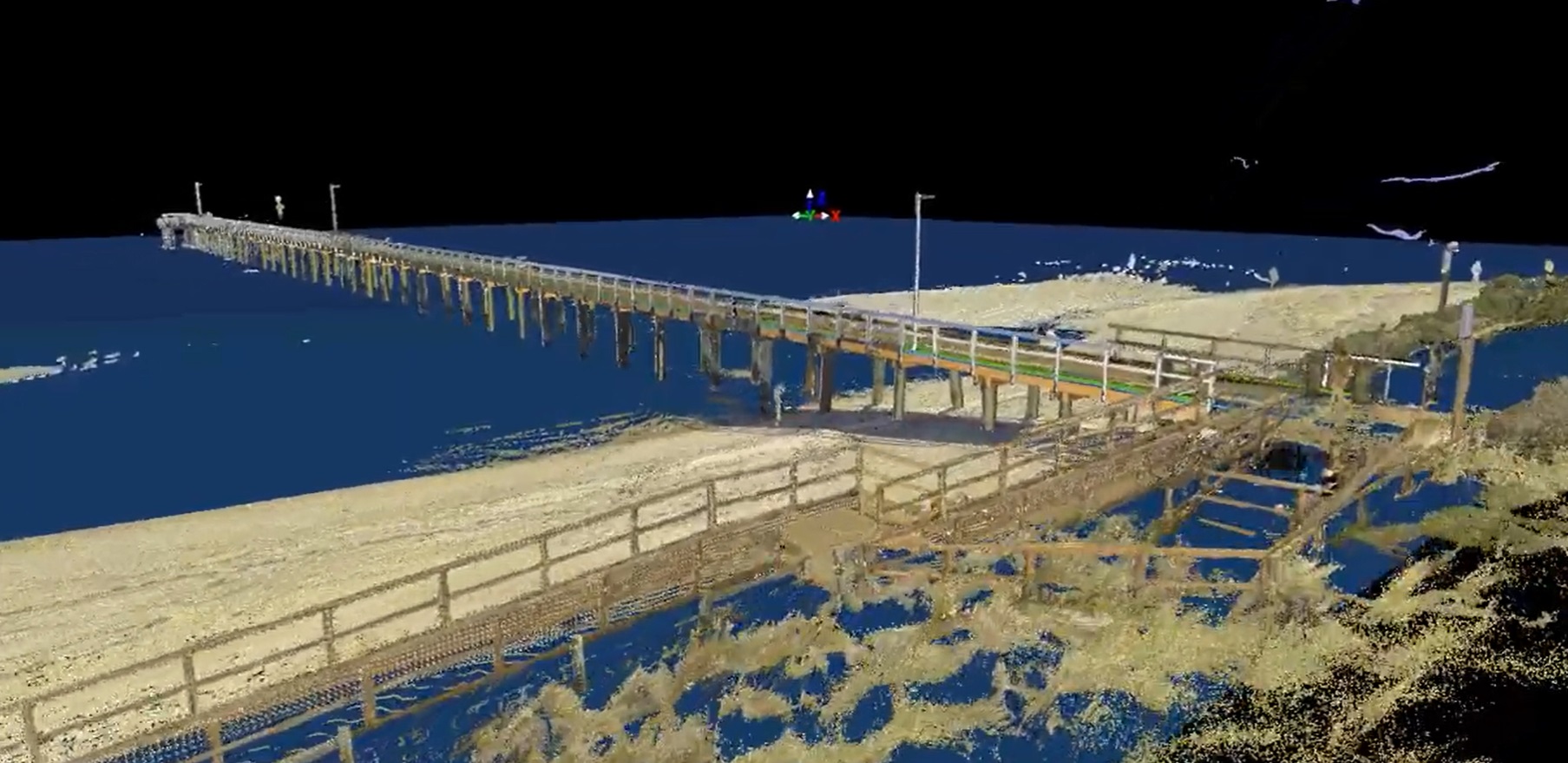
Laser scanning, nowadays, has emerged as a game-changer, revolutionising the way industries capture, analyse, and visualise three-dimensional environments. The demand for accurate spatial data capture today is greater than ever, especially in the construction, engineering, architecture, and surveying industries. Through laser scanning, laser pulses are emitted, measuring the time it takes for them to return. This working principle creates detailed point clouds that accurately represent the geometry and features of a site environment.
Shillong Design offers laser scanning as one of its services, providing the needed benefits of various site environments in terms of modern spatial data capture.
The Principles of Laser Scanning
Laser scanning works by emitting laser beams in a sweeping motion across the target area. These beams reflect off surfaces, and the time it takes for them to return to the scanner is measured.
By calculating the distance between the scanner and each point of reflection, a highly accurate 3D point cloud is generated, capturing the precise geometry and features of the scanned environment. Laser scanning technology can capture millions of points per second, allowing for incredibly detailed and comprehensive data capture.
Laser Scanning: Primary Benefits
Several benefits are associated with laser scanning. Some of them are as follows.
• Unparalleled Accuracy: Laser scanning offers unparalleled accuracy, capturing precise 3D spatial data with minimal margin of error.
• Enhanced Efficiency: Laser scanning significantly reduces data collection time compared to traditional surveying methods, saving time and resources.
• Guaranteed Safety: Laser scanning allows for non-contact data capture, eliminating the need for surveyors to enter hazardous or hard-to-reach areas.
• Improved Visualisation: Laser scans can be converted into detailed 3D models, enabling stakeholders to visualise and interact with the scanned environment remotely.
Applications of Laser Scanning
Many industries and fields can maximise laser scanning.
First, laser scanning can be widely used in construction for site surveying, progress monitoring, and quality control. Contractors can utilise laser scans to create accurate 3D models of existing structures, facilitating design and planning processes. In engineering, laser scanning is utilised for as-built documentation, facility management, and clash detection in complex projects. By capturing accurate spatial data, professional engineers can streamline design processes and identify potential issues before construction begins.
Surveyors also rely on laser scanning for topographic mapping, land development, and cadastral surveys. Laser scans enable us to collect highly accurate spatial data, reducing the need for traditional survey methods and minimising field time.
Architects may also leverage laser scanning to capture existing building conditions for renovation, restoration, and preservation projects. Laser scans provide architects with detailed as-built information, allowing them to design with precision and accuracy.
Laser scanning by Shillong Design has transformed the way industries capture and analyse spatial data, offering unmatched accuracy, efficiency, and safety in industries ranging from construction to surveying. With its ability to capture detailed 3D point clouds of site environments, laser scanning has become vital for modern spatial data capture, empowering professionals from various industries to make informed decisions and streamline workflows with confidence.